|
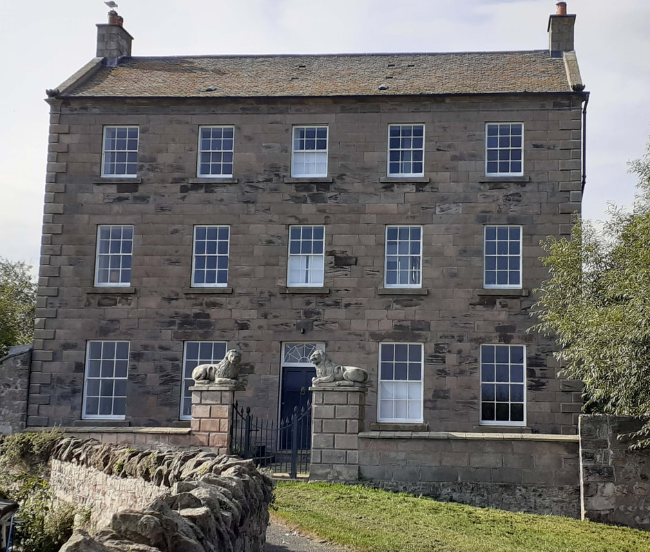
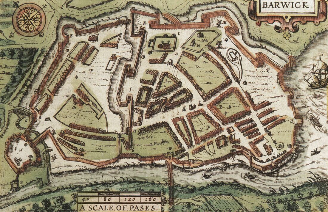
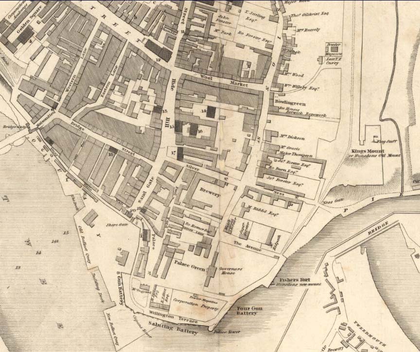
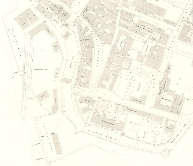
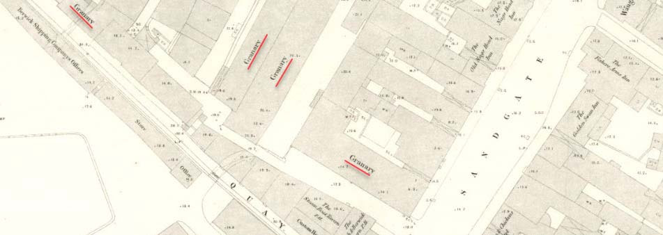
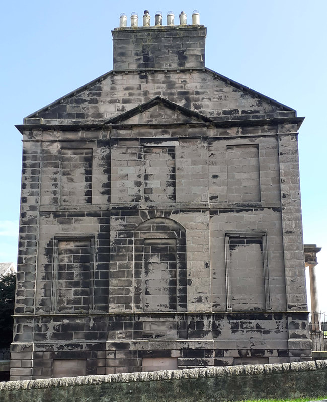
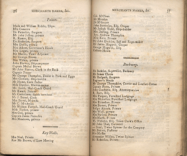
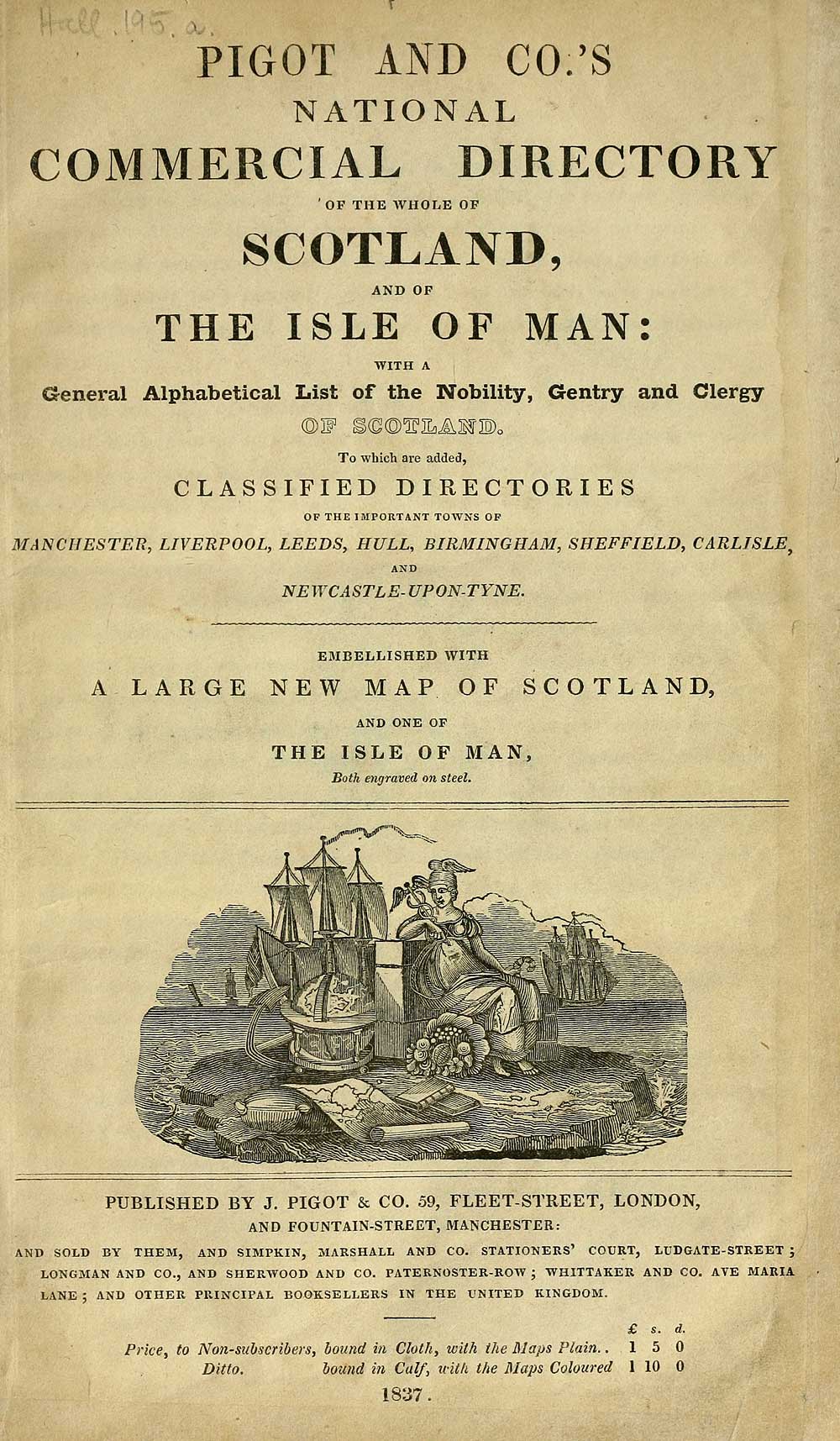
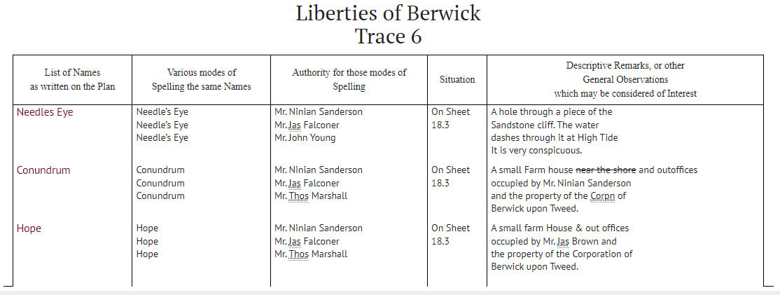
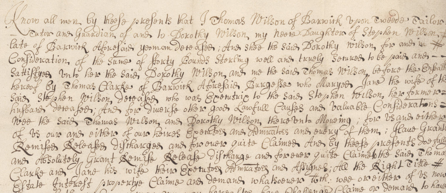
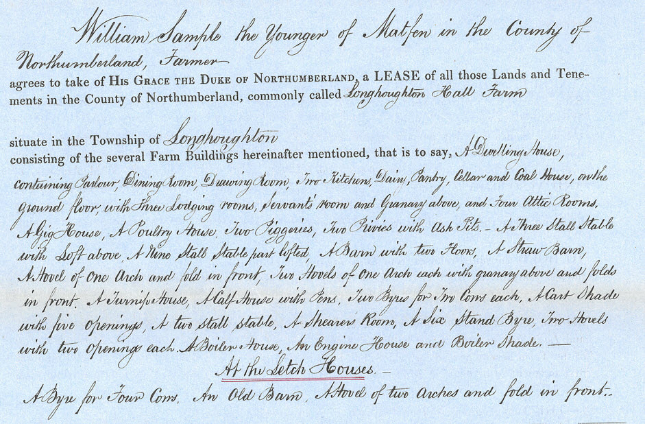
There is no better way to add context to family history than to research the homes, places and communities where ancestors lived. With the return of 'A House Through Time' for Series 4, there is a resurgence of interest in buildings associated with ancestral heritage. If looking for some guidance, the October edition of Family Tree Magazine, dubbed a #househistory special, is a great place to start. Not only does it feature an exclusive interview with the show's presenter, Professor David Olusoga, but editor Helen Tovey dives behind the scenes for a sneaky peek into the making of the programme. (A link to Helen's interview with Mary Crisp and Caroline Miller, two of the show’s producers, is included in this month's newsletter.) The magazine also contains a guide to using maps, practical house history case studies and the top ten sources for researching ancestor homes from Kathryn Feavers. Kathryn has been a member of the research team from Series 1. These are great, and many of the sources will already be familiar to readers but there are always more! I recently had the chance to take a short walk around Berwick-upon-Tweed 'old town'. I love to lose myself in the views of the sea from the Elizabethan Walls. I can imagine the 'Smacks', other sailing ships and boats waiting to be loaded with local goods, or, to spill their precious cargos from further afield onto the old quayside. The town is packed to the gunwales with so many intriguing buildings and interesting architecture it is easy to visualise the streets, yards and alleyways bustling with colour and activity during different periods of history. This month's blog seems a great place to share a few insider tips on where to find additional information. And for a local flavour what better place to start than Berwick. 1. Maps and Town Plans I am in complete agreement with Kathryn that maps are a great place to start. With a good run, it is possible to compare landscapes both rural and urban over a long period. Many historic maps and town plans are available through the National Library of Scotland. Amongst them is John Wood's detailed town plan of Berwick from 1822. Wood's series of maps of Scottish towns are particularly useful as they pre-date the census by some 20 years and contain a scattering of names of the proprietors. The accompanying book containing descriptive accounts of his town 'atlas' and some fascinating snippets of historical context, is available through Archive.org. The entry for Berwick begins on page 48. Looking at the route of my recent walk on Wood’s 1822 map, the space surrounding the buildings in Palace Street and Wellington Terrace is quite striking. There almost appear to be fewer buildings than depicted in John Speed's map of 1611 above. The new Governor's House and grounds built in 1719 to house the Governor of Berwick Garrison, dominates the east side Palace Green in blissful solitude. Thirty years later the large-scale ordnance Survey map of 1852 shows the area to have an Industrial School, the Tweed Brewery, a Bowling Green, Readings Rooms and several new homes. 1852 also bears witness to the importance of the corn trade, with many large granaries occupying the roads adjacent to the Quay Walls. 2. Listed Building Register (Historic England & Historic Environment Scotland)Most buildings in England that pre-date 1840 have a 'record'. Thus, if a building is old it is always worth checking to see if it is 'listed'. A search of the relevant registers of England and Scotland is easy and free. Entries include more detailed descriptions of the architectural features or historical significance of a building or the reason for its inclusion. They are often brief, but at times the records contain some great nuggets of information. This Historic Buildings Report attached to the entry for 84 Ravensdowne is a fantastic example of what it may be possible to find! Locating the stories of the people though, will most often require investigation elsewhere. The western gable of No 1 Wellington Terrace (the home of John Miller Dickson (1771 – 1848) has always intrigued, with its blanked off windows blinding the view towards Tweedmouth. A house on the Walls at the corner of Wellington Terrace and Palace Street is known today as the 'Old Whaling House'. It appears on the 1852 map as 'Bay View'. At one time Berwick was also a whaling port, albeit on a small scale. The ship 'Norfolk', famed for surving an ice-bound winter in the Davis Straits in 1836 was the property of John Miller Dickson, the owner and occupant of 1 Wellington Terrace. The old ' whale oil' refinery stands on Pier Road. It is now flats with fabulous views over the mouth of the Tweed with its pier and lighthouse, and to the sea beyond. 3. Berwick upon Tweed 'Our Families Project'A searchable database for High Greens, Low Greens and Ravensdowne, created as part of the HLF 'Our families Project' organised by Berwick Record Office, is also available online. The database contains information collated by volunteers from censuses, electoral registers, parish records, newspapers and other sources. It's a great little resource but very sadly Berwick specific. Nonetheless, it is an example of the type of information available for a specific property investigation. It is accessible via The Friends of Berwick and District Museum and Archives website. 4. The Berwick Directory of 1806Trade Directories are another 'go to' for information on a place as well as its people. The Berwick Directory of 1806 provides a glimpse of the town and its community during the Georgian era. The layout allows for searching by surnames, streets and place names, trades and professions, carriers and public houses. (Backway was one of the alternative names used for Ravensdowne, as was Union Street but neither 'stuck'.) The National Library of Scotland holds Scottish Post Office and other Trade Directories, such as 'Pigots' and 'Slaters' for Scotland. The 1837 Scottish edition of Pigot's also includes Berwick upon Tweed and a few other important 'towns' in England as well as the Isle of Man. The directories are free to access and download. 5. OS Place NamesIf looking for places that no longer exist, Ordnance Survey Name Books are worth a try. Thanks to the project 'Northumberland Name Books — Places and People c. 1860' names of places in Northumberland, recorded by the Royal Engineers surveyors and aided by local civilians 'in the know', are available to search online. (This site carries a 'rabbit hole' warning! I looked at the page for Longhoughton and although I recognised many of the old names, such as Letch Houses that appear in a family tenancy agreement of 1872, I confess many were new to me. One that was unfamiliar and caught my eye was 'Broken Stirrup', a gully in Ratcheugh Crag) The Scottish OS Name Books are accessible free through Scotland's Places. The website also contains a plethora of other information relating to property: Land Tax Rolls 1645 - 1831, Window Tax 1748 – 1798, Cart Tax Rolls 1785 – 1798, Farm Horse Tax Rolls 1797 – 1798, as well as old maps, drawings and photographs. 6. Valuation RollsStaying north of the Border, the Valuation Rolls available through the Scotland's People Website can also be enormously helpful when tracing the history of a property and its occupants. As well as homes, these records also include business premises such as farms, shops, churches, schools and a few oddities such as railway stations. Their purpose was to assess the rate of tax due on a property. The assessor in each county or parliamentary burgh compiled annual valuation rolls, listing most buildings and other property in their areas, along with the names and designations of the proprietor (owner), tenant and occupier, and the annual rateable value. The records cover the period 1855 – 1940, and there is a helpful guide to using these records on the Scotland's People Website. The Index is free to search, but to view or download a record will cost 2 credits or 50p. Although it is possible to search by parish and place it can be a little tricky identifying a specific property as street names and numbers were often absent in the earlier records. Knowing the surname of the owner, occupant or neighbours will help a lot. The level of information provided in the returns varied year on year. But as the records were created for tax assessment purposes, they do have their limitations. 7. DeedsDeeds are a large, complex and interesting topic that deserve a blog of their own. Only a very brief overview appears below. For present-day enquiries, a search of the Title Registers held by the relevant Land Registry for each Country will establish the current owner and extent of a property. For England, this is HM Land Registry, and in Scotland, the Scotland Land Information Service through the Registers of Scotland. In Scotland before the introduction of the Land Register, Deeds (or Sasines) relating to land and property were recorded in the Sasine Register. Some sasines are accessible through Registers of Scotland but the National Records of Scotland holds the majority. Click here for the NRS online guide to sasines and searching the sasine registers. Alternatively, there are various companies and organisations that (for a fee) will help navigate the systems and obtain the available property records for you. In England, local record repositories and archives often hold historic Deeds and other documents associated with land transactions. Transactions in land to prove ownership have been recorded since the Medieval period. Transactions in Freehold land came in different forms; Gift, Quitclaim, Letters Patent, Bargain and Sale, Lease and Release, Feoffement, Final Concord, Common Recovery, Deed of Covenant and Grant or Conveyance. More details on their specific purpose and distinguishing features can be found online in an 'Introduction to Deeds in Depth' at The University of Nottingham. They also appeared as hybrid documents such as the transcription extract taken from a document dated 1640 held at Berwick upon Tweed Record Office. It is for the Bargain and Sale with Feoffement of a property in Bridge Street lying between properties belonging to William Morton, gentleman, and George Smith, Burgess. To all Christian people to whom this p[re]sent Writeing shall come I Edward Wilson of the towne & County of Newcastle upon Although introduced in 1862, land registration was not made compulsory until 1899. In Scotland, the General Register of Sasines was introduced in 1617 and was the first national land register in the world. The biggest problem is that historically only a small proportion of the population owned land and property! 8. Estate Records and Rental RollsMost land and property, particularly in rural areas, was in the ownership of a handful of individuals. These 'Estates' then let their land and property to others. As a result, lease and rental records such as 'Rental Rolls' can often be more informative on a property's history than those relating to its ownership. Although some estates on both sides of the Border still retain their records, many have made them available to the public via national or local archives and record offices. For example, Berwick Record Office holds historic Rental Rolls for the Ford and Etal Estate amongst its records. The various tenants of the farm where I grew up (featured in my July blog), were traced back to the early 1800s through rental agreements and tenancies. The associated schedules make fascinating reading and illustrate how the farm changed shape over the years to accommodate the arrival of the railway, the new road to Boulmer, the expansion of Longhoughton Village and the coming of the Royal Air Force. They also document the changes to the farmhouse living accommodation, both cosmetic and functional. At one point in time, it appears there was another floor containing four attic rooms and what would become my own bedroom, may once have been a granary. ConclusionThe eight sources outlined above will hopefully provide some inspiration for new places to research. Not only for information about your ancestors, but also their homes, other associated buildings such as shops or farms, and the area and communities in which they lived. Weaving historical context gleaned about homes and communities into ancestral information brings another dimension and dynamic to family history research Useful Links 1806 Directory for Berwick
http://rgcairns.orpheusweb.co.uk/DirectoryContents.html National Library of Scotland, Maps and Plans of Berwick https://maps.nls.uk/towns/berwick.html Historic England https://historicengland.org.uk/listing/the-list/ Historic Environment Scotland https://www.historicenvironment.scot/advice-and-support/listing-scheduling-and-designations/listed-buildings/search-for-a-listed-building/ National Library of Scotland, Scottish Post Office Directories https://digital.nls.uk/directories/index.html Scotlands Places, Berwickshire Records https://scotlandsplaces.gov.uk/search/place/berwickshire Northumberland County Council , Extensive Urban Survey Project 2009. List of Listed Buildings in Berwick Appendix Page 60 https://www.northumberland.gov.uk/NorthumberlandCountyCouncil/media/Planning-and-Building/Conservation/Archaeology/Berwick.pdf Northumberland Name Books, Berwick, http://namebooks.org.uk/browse/main/?OSref=154&Page=35&indexPage=1 Scotland’s People Guide to Valuation Rolls https://www.scotlandspeople.gov.uk/guides/valuation-rolls Nottingham University, ‘Introduction to Deeds in Depth’ https://www.nottingham.ac.uk/manuscriptsandspecialcollections/researchguidance/deedsindepth/introduction.aspx Friends of Berwick and District Museum and Archives www.berwickfriends.org.uk/
2 Comments
Peter Chrisp
26/9/2021 03:59:18 pm
Thanks for the timely information about Berwick - I am making my first visit to the Berwick record office on Thursday!
Reply
Susie Douglas
26/9/2021 06:25:59 pm
That's great Peter.
Reply
Leave a Reply. |
AuthorSusie Douglas Archives
August 2022
Categories |
Copyright © 2013 Borders Ancestry
Borders Ancestry is registered with the Information Commissioner's Office No ZA226102 https://ico.org.uk. Read our Privacy Policy
